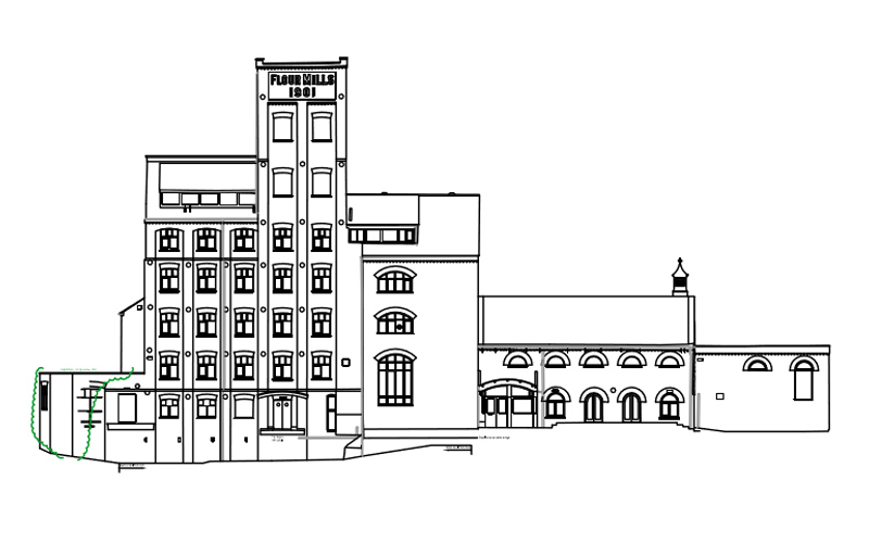
Type: Measured Building Survey
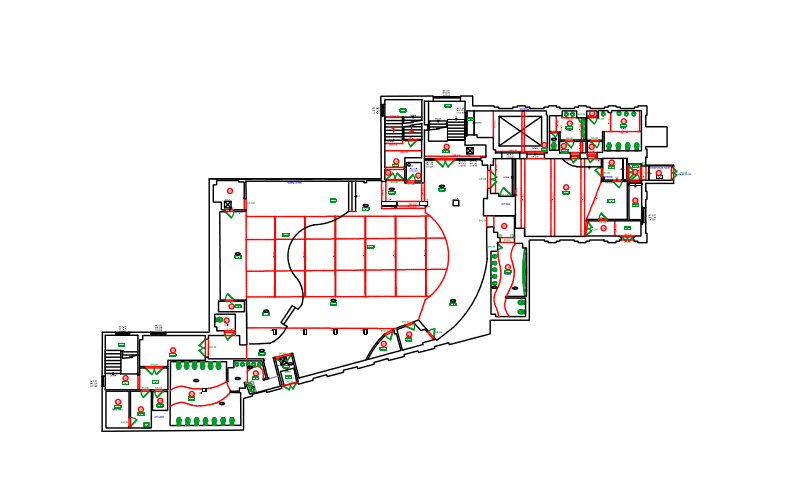
Requirements: Full 2D topographical survey including underground service tracing, building elevations, floor plans and cross sections of the former Flour Mills site in Ashford.
Methodology: Undertake a forced centre traverse around the site to provide a fully georeferenced control network tied into Ordnance Survey grid and datum. With this framework in place our Surveyors were able to collect the pertinent site data using a TS16 Leica Total Station in tandem with a Leica GPS with SmartNet capabilities. This fully coded referenced information was then downloaded and processed through our software to create a full 2D AutoCAD plan of the site.
This information was used to complete the utility mapping of the site. In tandem with this the control was transferred into the building, and linking our TS16 with the latest MBS software we measured all of the detail for the plan plans below. Finally we coupled our survey detail with a laser scan of the external faces of the building to prepare full external building elevations.
R L Surveys Ltd is Registered in England & Wales
No. 07706617 Registered Office: 128 Lakemead, Ashford, Kent. TN23 4XZ
R L Surveys Ltd are VAT Registered.