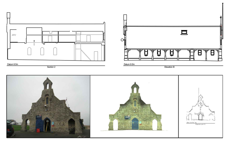
Type: Measured Building Survey
Requirements: Full building elevations, floor plans and cross sections of Walmer Lifeboat Station.
Methodology: The external of the property was scanned using a Leica C10 scanstation on high resoluation (recording a point every 10mm at a distance of 100m from the scanner). Each individual scan was registered together to create a point cloud which was reference to Ordnance Survey grid and datum using traditional survey methods. From this point cloud we were able to isolate the various elements on the building to produce the 2D building elevations
R L Surveys Ltd is Registered in England & Wales
No. 07706617 Registered Office: 128 Lakemead, Ashford, Kent. TN23 4XZ
R L Surveys Ltd are VAT Registered.